

You're now following
Error following user.
This user does not allow users to follow them.
You are already following this user.
Your membership plan only allows 0 follows. Upgrade here.
Successfully unfollowed
Error unfollowing user.
You have successfully recommended
Error recommending user.
Something went wrong. Please refresh the page and try again.
Email successfully verified.

bogor, indonesia
It's currently 8:18 AM here
Joined July 26, 2009
0 Recommendations
Handy R.
@konservasi
1.5
1.5
100%
100%
bogor, indonesia
100%
Jobs Completed
100%
On Budget
100%
On Time
N/A
Repeat Hire Rate
I am an GIS Expert. I have been for 10 years
Contact Handy R. about your job
Log in to discuss any details over chat.
Portfolio
Portfolio

My customer
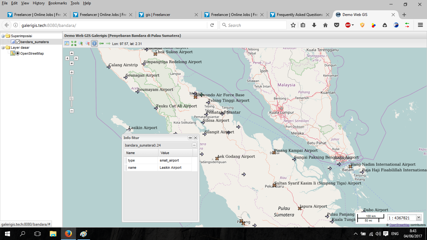

Airport map in Sumatera Island with Web GIS application
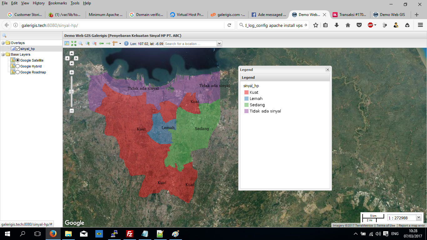

Strength provider mobile company (Web GIS application)
My customer
Airport map in Sumatera Island with Web GIS application
Strength provider mobile company (Web GIS application)
Reviews
Changes saved
Showing 1 - 1 out of 1 reviews
€10.00 EUR
Graphic Design
HTML
Illustrator
Photo Editing
Photoshop
N

•
Experience
Freelance
Apr 2010 - Present
I have build my own business withthe website http://galreigis.com. From this year I have sell digital map but now I am focus in services of GIS. I also offer Web GIS worked
GIS Consultant
Sep 2007 - Oct 2009 (2 years, 1 month)
I am responsibe to do GIS worked such as digitize a map. analysis of overlay the vector maps and count the area according the map. I also responsible to analyze raster image. I usually analyze landcover. I am using landsat and any other raster image
Education
Bachelor Degree
(6 years)
Contact Handy R. about your job
Log in to discuss any details over chat.
Verifications
Top Skills
Browse Similar Freelancers
Browse Similar Showcases
Invite sent successfully!
Thanks! We’ve emailed you a link to claim your free credit.
Something went wrong while sending your email. Please try again.
Copy to clipboard failed, please try again after adjusting your permissions.
Copied to clipboard.
Loading preview
Permission granted for Geolocation.
Your login session has expired and you have been logged out. Please log in again.