

You're now following
Error following user.
This user does not allow users to follow them.
You are already following this user.
Your membership plan only allows 0 follows. Upgrade here.
Successfully unfollowed
Error unfollowing user.
You have successfully recommended
Error recommending user.
Something went wrong. Please refresh the page and try again.
Email successfully verified.

guelmim, morocco
It's currently 3:02 PM here
Joined May 16, 2017
1 Recommendation
Ayoub L.
@ayoubGis
4.2
4.2
100%
100%
guelmim, morocco
100%
Jobs Completed
100%
On Budget
100%
On Time
20%
Repeat Hire Rate
GIS, RS & Territorial Development
Contact Ayoub L. about your job
Log in to discuss any details over chat.
Portfolio
Portfolio

Spatial analysis

Spatial analysis
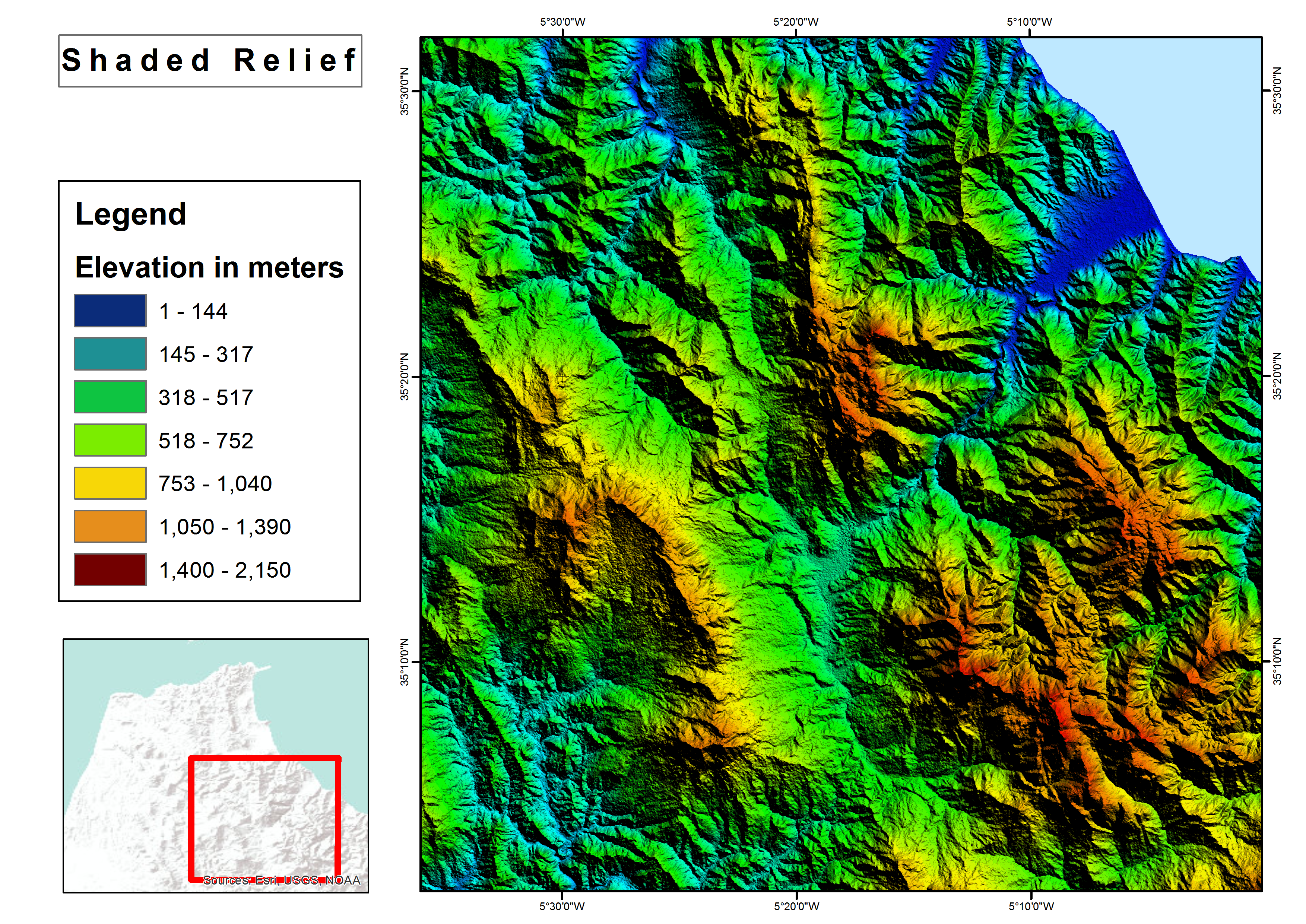

Shaded relief map
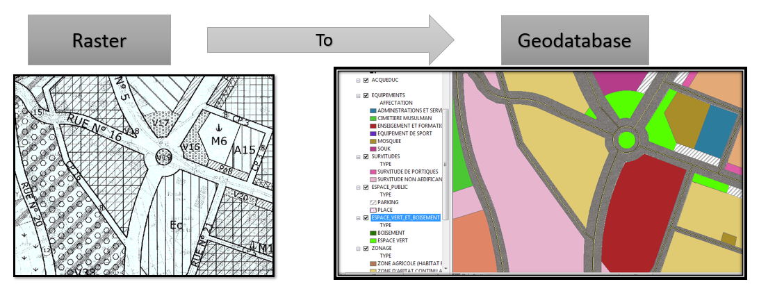

Raster to Geodatabase
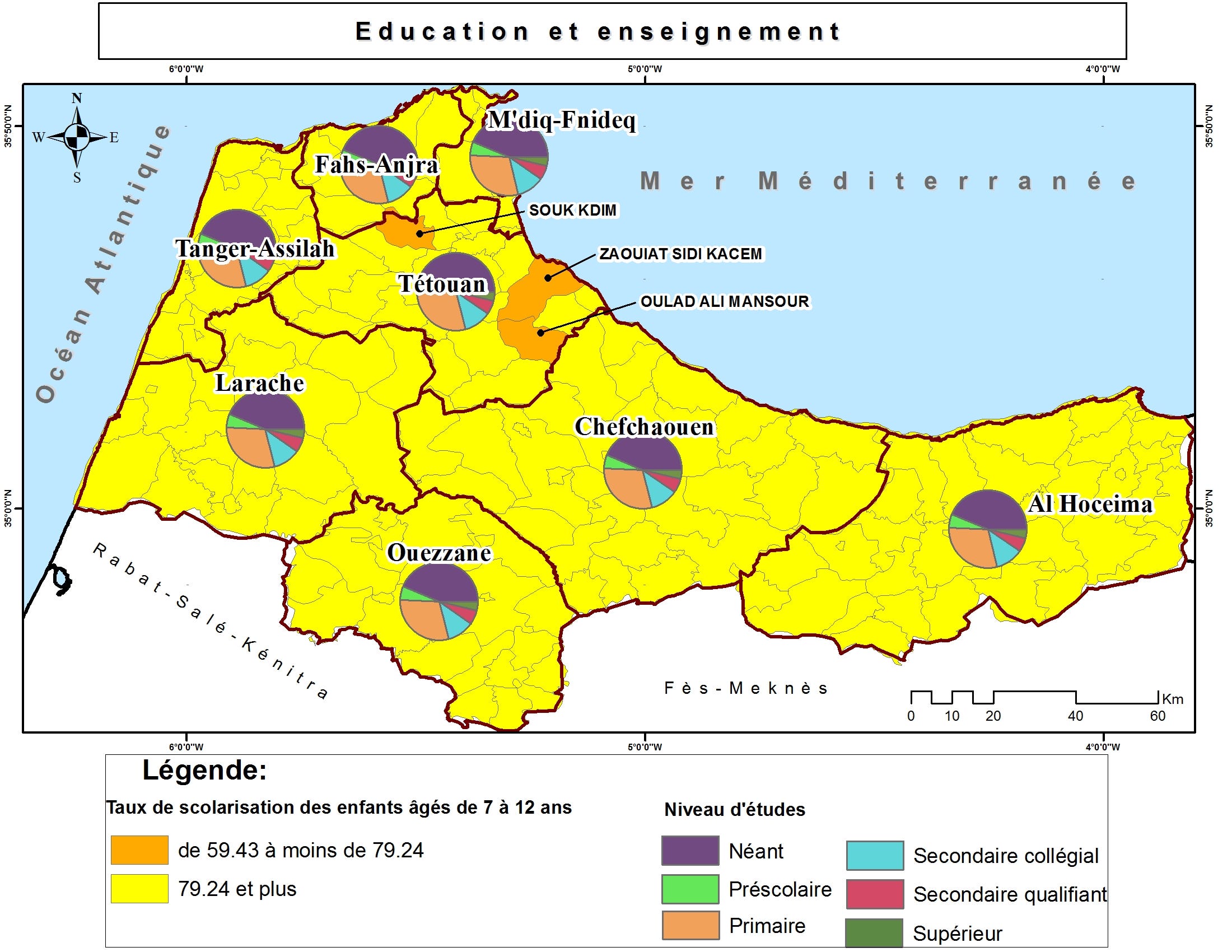

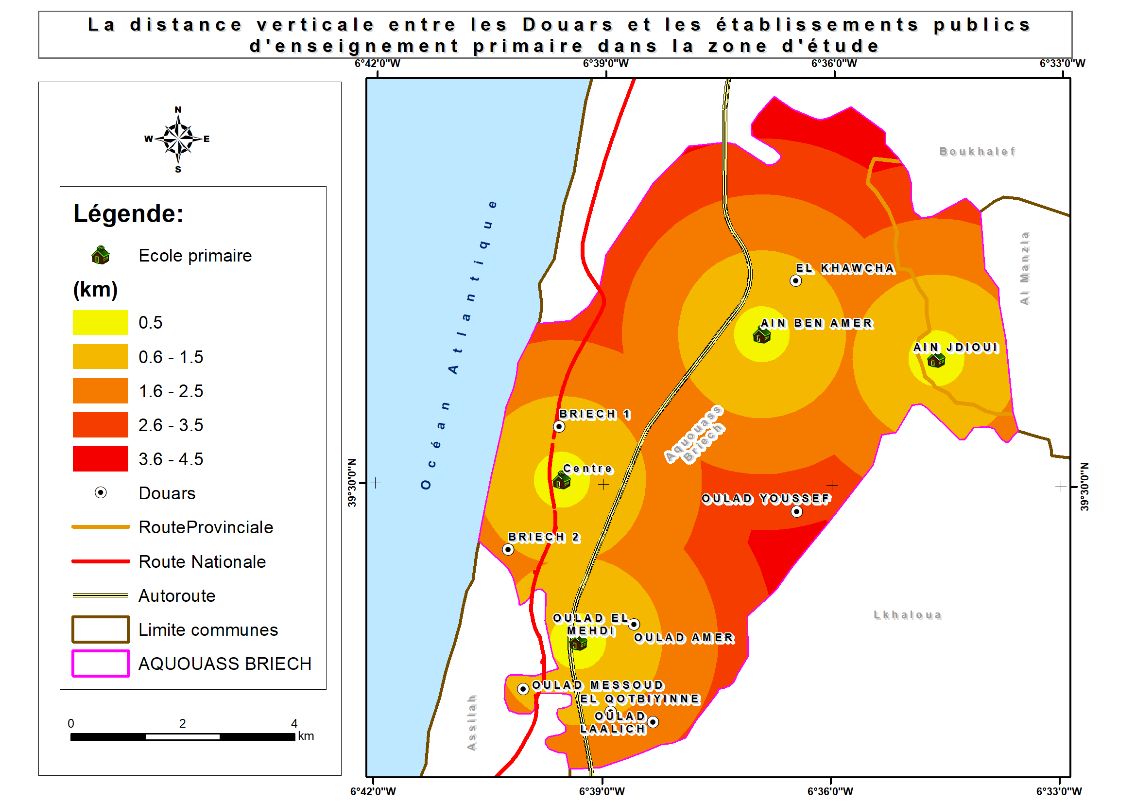
Thematic maps

Thematic maps

Thematic maps

Thematic maps

Brochure with Business Card

Brochure with Business Card
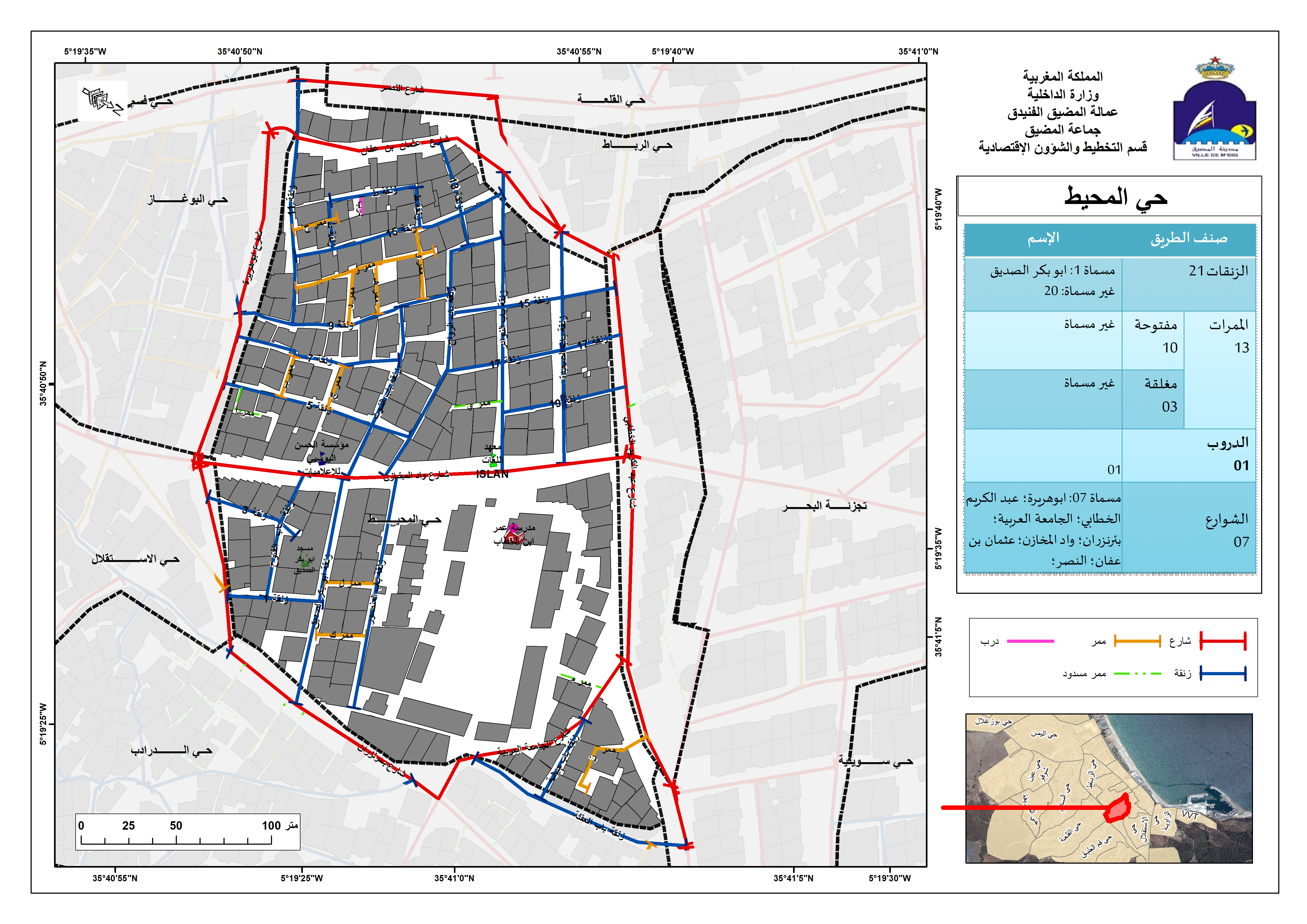

Street Addressing and Naming System
Spatial analysis
Spatial analysis
Shaded relief map
Raster to Geodatabase
Thematic maps
Thematic maps
Thematic maps
Thematic maps
Brochure with Business Card
Brochure with Business Card
Street Addressing and Naming System
Reviews
Changes saved
Showing 1 - 5 out of 9 reviews
$150.00 USD
Data Processing
Data Mining
Geospatial
JSON

•
€40.00 EUR
N

•
$10.00 USD
PHP
Data Processing
Data Entry
Excel
Web Scraping
A
•
€90.00 EUR
N
•
$50.00 USD
Logo Design
Illustrator
Prezi
Geospatial
+1 more

•
Experience
GIS Specialist
Jan 2018 - Present
• Performed geospatial analyses;
• shared interactive maps and services in ArcGIS Online;
• Collected and processed Landsat images for M’diq city;
• Used GIS technique (Desktop/Mobile) and Microsoft Access in business activities survey;
• Mapped a land use plan for M'diq-Fnideq prefecture beach;
• Designed billboards for Beach;
• Created Gis-based Street Addressing and Naming System;
• Mapped a Traffic Signs plan for M’diq city;
• Created compelling visual presentations.
Cartographer/GIS
Jan 2017 - Jun 2017 (5 months, 1 day)
Designed land use plan using Geographical Information System.
GIS Intern
Aug 2016 - Sep 2016 (1 month, 1 day)
Created Geodatabase for Guelmim-Oued Noun Regional Roads.
Education
Master's degree, Territorial Development and Spatial Governance
(3 years)
Bachelor's degree, Geography
(3 years)
Contact Ayoub L. about your job
Log in to discuss any details over chat.
Verifications
Top Skills
Browse Similar Freelancers
Browse Similar Showcases
Invite sent successfully!
Thanks! We’ve emailed you a link to claim your free credit.
Something went wrong while sending your email. Please try again.
Copy to clipboard failed, please try again after adjusting your permissions.
Copied to clipboard.
Loading preview
Permission granted for Geolocation.
Your login session has expired and you have been logged out. Please log in again.